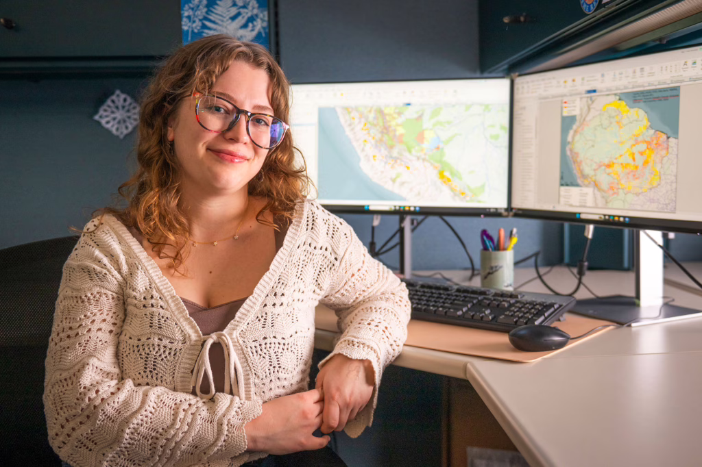
As she nears the end of her undergraduate years at Clark, environmental science major Julia Head ’26, M.S./GIS ’27, has begun checking off her to-do list.
It includes completing research papers for her classes in the School of Climate, Environment, and Society; tackling an honors thesis and final project for her yearlong Human-Environment Research Observatory (HERO) Fellowship; participating in rehearsals and performances for the student Variant Dance Troupe; and firming up her post-Commencement plans, including Clark’s 4+1 Accelerated Master’s Degree program in Geographic Information Science (GIS) next fall.
And then there is one more task: finishing 10 GIS-based maps to be released worldwide as part of a multinational, multi-institutional research project examining the potential impacts of a Chinese “megaport” on the Peruvian Amazon.
“I feel a huge responsibility,” Head says. “I’m very honored to be on this project.”
Led by Sustainability and Social Justice professor and principal investigator Denise Humphreys Bebbington, the project involves a team of researchers from Clark and Peru. It is funded by a two-year, $920,000 grant from the Gordon and Betty Moore Foundation.
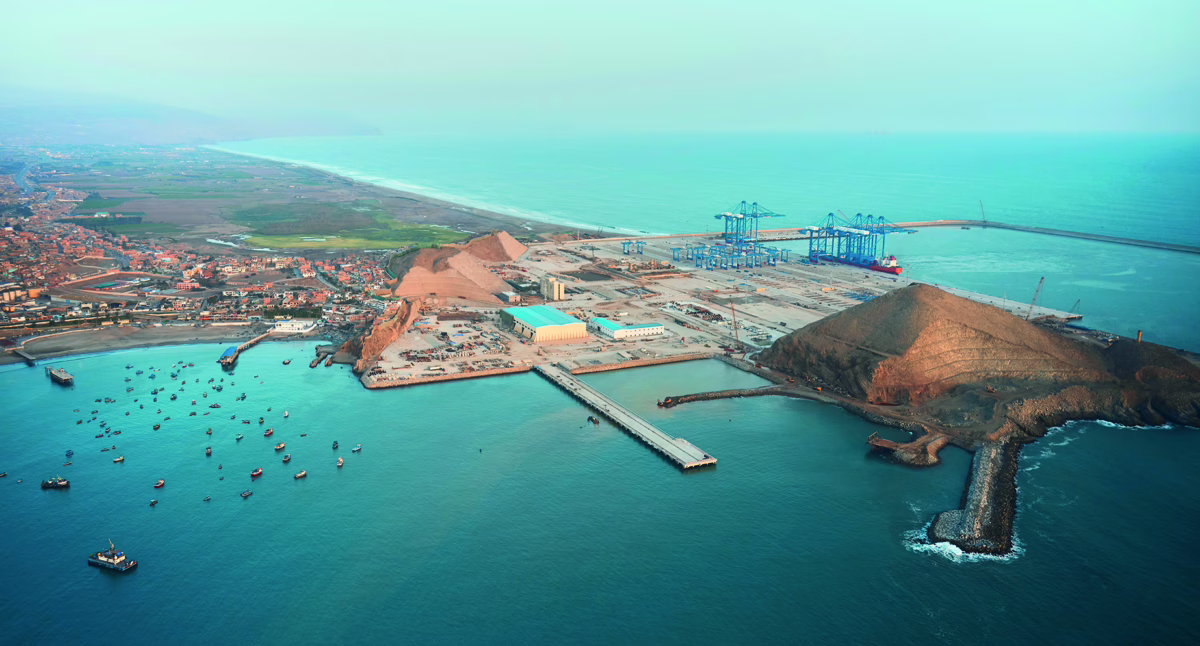
With the Peruvian government’s blessing, the China-based COSCO Shipping company, a state-owned enterprise, began building the Port of Chancay in June 2021, about 50 miles north of Lima.
When completed, the $3 billion-plus megaport could transform trade between South America and Asia.
‘Where are those shipments coming from, and which routes are likely to be used?’
Little information has been shared publicly about the actual costs or goals of the project, which “largely flew under the radar because it was private,” Humphreys Bebbington says. “What it is, and what it aspires to be — there’s a big gap.
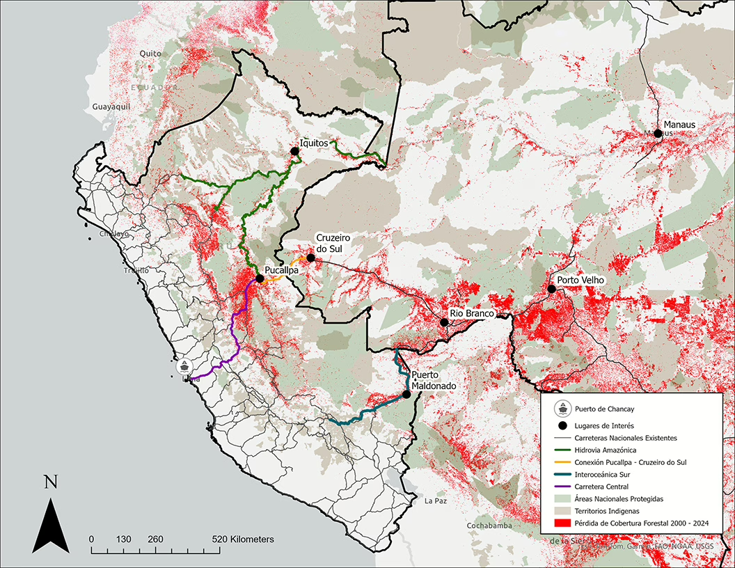
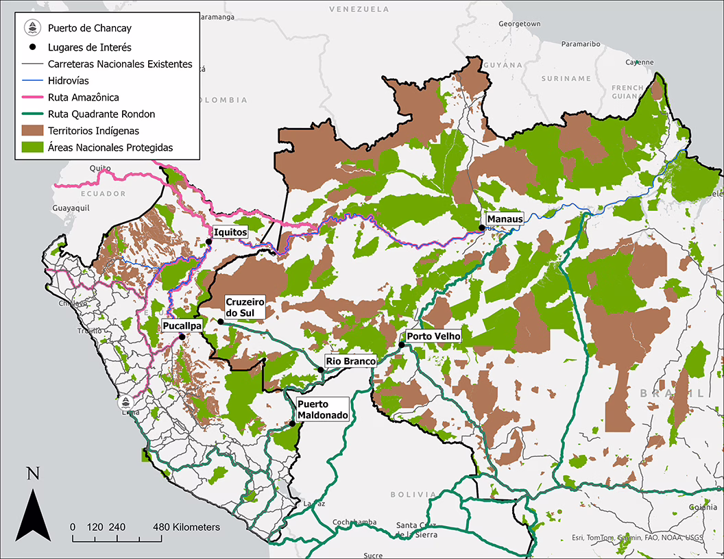
“It’s potentially the largest deep-water port on the Pacific Coast of South America,” she says. “This hub port can receive shipments that can be loaded onto Ultra Large Capacity Vessels bound for Shanghai. The big question is: Where are those shipments coming from, and which routes are likely to be used?”
Many believe that Peru and Brazil’s governments and private companies might expand and build more roads, railways, and other transport infrastructure to connect the Chancay port with the western Amazon.
If so, these investments could have multidimensional impacts on the 2.7 million-square-mile rainforest that serves as a critical global carbon sink, says Humphreys Bebbington, a founding member of Extractives@Clark (the Clark Center for the Study of Natural Resources Extraction and Society).
“We are investigating what the port’s implications might be in the western Amazon,” Humphreys Bebbington says, “and whether it might act as a catalyst for deforestation, habitat loss, and expansion of gold mining and other extractive activities in remote areas.”
Besides Humphreys Bebbington, the Clark team includes Geography Professor John Rogan; Peru-based project manager and field research coordinator Pilar Delpino Marimón, Ph.D. ’25; Tanner Honnef ’24, M.S./GIS ’25, who began the mapping project that Head now continues; Fulbright Fellow Vee Dayandayan, M.S./ID ’25; and Ana Lucía Araujo Raurau, a Ph.D. student in geography from Peru and expert on Indigenous cultures. Araujo spent 1-1/2 months last summer interviewing community members and tradespeople in Peru’s Atalaya Province, part of the central Amazon rainforest.
“We’re trying to create an infrastructure by which things can be monitored, analyzed, and disseminated to the public, which currently is not happening,” Humphreys Bebbington explains.
The GIS maps, for example, will help the public visually conceptualize the port’s potential impacts — and even pinpoint borders. “A lot of people don’t realize where the boundary of the Amazon starts,” according to Head.
Now a GIS specialist with Liberty Utilities in California, Honnef “created maps of potential shipping routes from the Amazon to the Peruvian coast, along with biodiversity maps to show the potential impacts of increased traffic on the environment,” he says. “Those making decisions need to be able to understand the analysis, even if they do not have a background in spatial analysis.”
Undeveloped roadways leading to the Amazon: ‘We should look into this’
Part of China’s sweeping Belt and Road Initiative, the port continues to receive support from Peru’s government, which hopes the development will spur economic growth. In 2024, Chinese leader Xi Jinping and then-Peruvian president Dina Boluarte attended the port’s inauguration, commemorating the completion of its first phase. Peru has cycled through two leaders since then; as of February, José María Balcázar was the interim president, with elections scheduled for April 12. Because of problems with the ballot-delivery system, the election results were not known before this story was posted.
The Clark researchers have teamed up with Peruvian partner César Leónidas Gamboa Balbín, a lawyer and executive director of the NGO, and Extractives@Clark is partnering with Derecho, Ambiente y Recursos Naturales (DAR), or Law, Environment, and Natural Resources, and the Center for the Study of China and Asia/Pacific (CECHAP) at the Universidad del Pácifico. Cesar Gamboa coordinates the work of the DAR team and Omar Narrea coordinates the work of the CECHAP researchers, which includes Leolino Dourado.

Humphreys Bebbington credits Delpino with inspiring the project. Delpino’s dissertation focused on the effects of the proposed Pucallpa-Cruzeiro do Sul road between Peru and Brazil, part of “a regional integration strategy from the early 2000s, but dating back to the early 1900s,” she says.
As Delpino researched the history and effects of unbuilt infrastructure projects and conducted fieldwork in these borderland areas, she heard from residents who feared that “we’ll connect with Chancay,” she recalls.
“A light bulb went off” as she realized that the stagnated road building projects eventually might be restarted, potentially leading to more development in the Amazon.
“We should look into this,” she told her research partners at Clark. “And here we are still talking about it.”
As Delpino soon discovered, Peru’s large-scale infrastructure projects lack “long-term planning,” which is exacerbated by unstable, rotating government leadership. Without a plan, she adds, “there’s a lack of the safeguards and considerations that you need to take into account to access these sensitive ecological and political spaces,” where Indigenous communities and isolated populations live in the rainforest, travel and fish on the rivers, and often play a role in helping protect the ecologically significant Amazon basin.
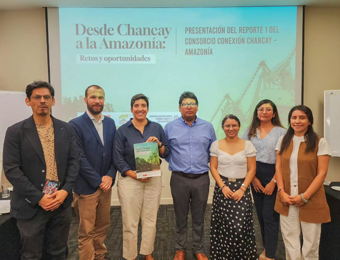
Recently, the research team released its first report in Spanish, which has drawn media attention in South America. Soon, they plan to release an English-language translation, followed by additional publications in both languages over the next year.
The reports will include the GIS maps developed by Head and Honnef, under Rogan’s and Delpino’s guidance, along with research data from Humphreys Bebbington, Delpino, Araujo, and their partners in Peru.
“We’re putting together the pieces of a complex puzzle,” Humphreys Bebbington says.