Clark University, through its School of Climate, Environment, and Society and School of Business, is launching the world’s first professional doctorate in the rapidly expanding field of geospatial technology, which is critically important in a range of industries central to the future of society. The new program is designed for mid-career professionals seeking to advance toward leadership positions in these sectors.
Set to begin in summer 2027, the two-year, low-residency Executive Doctor of Geospatial Leadership (DGEO) program is designed in collaboration with the World Geospatial Industry Council (WGIC), which is working with its more than 50 member organizations — including major players like Esri, Oracle, Amazon Web Services, TomTom, and Hexagon — to address a significant workforce gap and build a much-needed pipeline of geospatial leaders competent in both the technology and management challenges driving the industry.
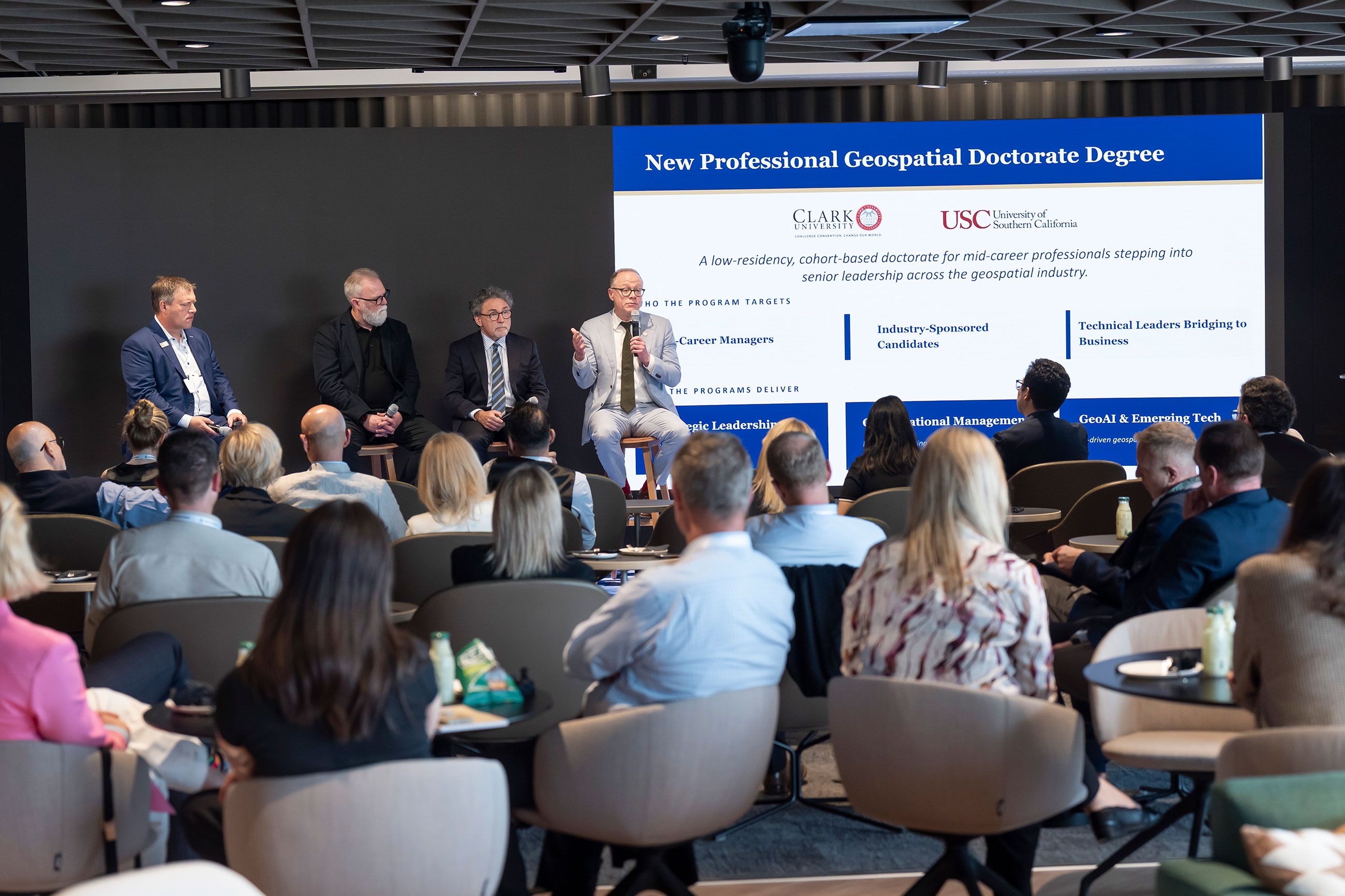
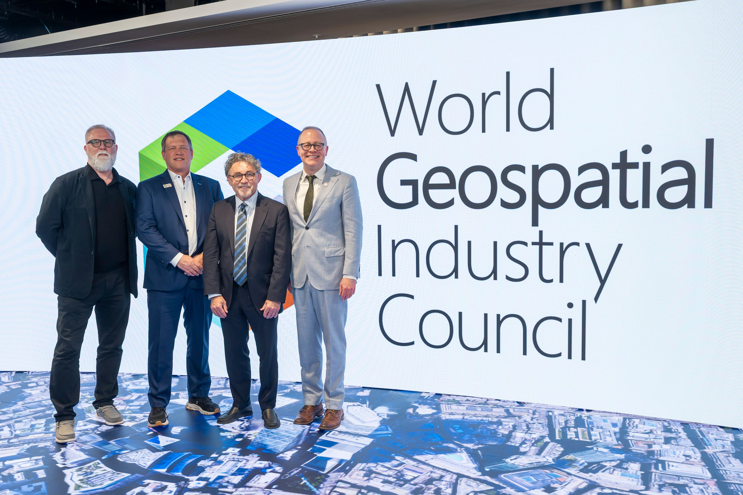
The new degree was announced on June 2 at the council’s flagship annual event, Horizons 2026, in London.
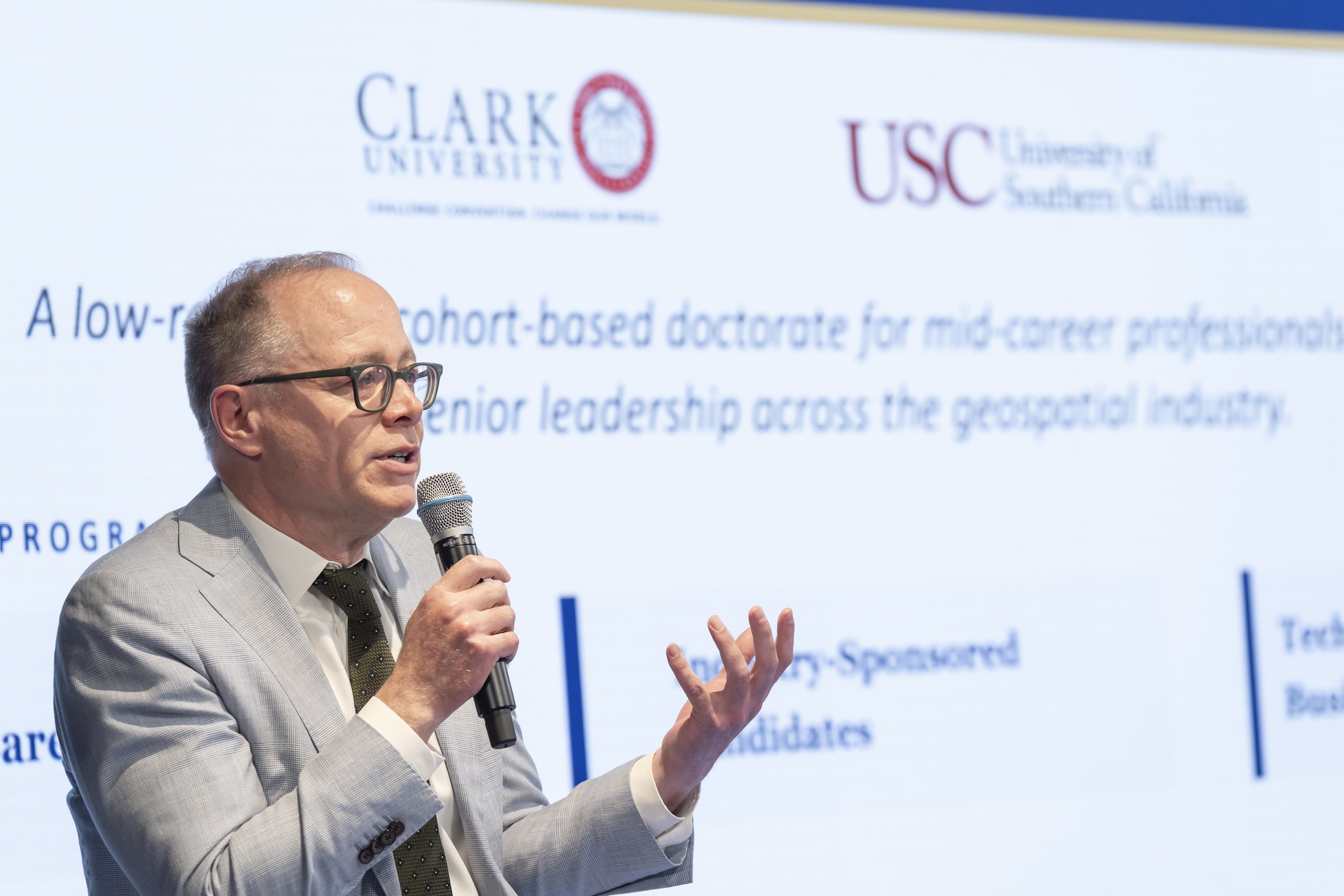
Lou Leonard, D.J.A. Spencer Dean of the School of Climate, Environment, and Society, speaks at the London launch of Clark’s new Executive Doctor of Geospatial Leadership (DGEO) program.
“We are at the point where the scale and impact of the geospatial industry has expanded greatly, moving beyond traditional GIS and remote sensing to integrate AI, machine learning, and data engineering.”
— lou leonard, D.J.A. Spencer Dean School of Climate, Environment, and Society
Offered primarily online, Clark’s DGEO program will introduce working professionals to the technical and executive skills they need to lead organizations that deploy geospatial technology, a critical infrastructure cutting across numerous sectors of the global economy, from insurance and business logistics to urban planning, agriculture and environmental monitoring.
Geospatial technology, for instance, is used to predict property risks from wildfires and floods; map global shipping routes; design climate-resilient cities; and track deforestation and biodiversity loss. The rise of artificial intelligence is both disrupting and accelerating the capacities of the industry. The demand for leaders who can bridge technical expertise and executive decision-making is growing sharply.
“We are at the point where the scale and impact of the geospatial industry has expanded greatly, moving beyond traditional GIS and remote sensing to integrate AI, machine learning, and data engineering,” says Lou Leonard, the D.J.A. Spencer Dean of the School of Climate, Environment, and Society. “However, with this growth have come workforce gaps for the industry, particularly at management levels, where integrating technological competence, particularly GeoAI, with executive skills is vital to leading organizations in a changing future.
“Clark is the perfect place to host the world’s first DGEO degree to foster the next generation of geospatial leaders,” Leonard adds, “especially given our decades-long history as a leader in geospatial sciences, our longstanding connections with Esri, NASA, and others foundational to the sector, and our recent leadership, together with IBM, at the forefront of GeoAI.”
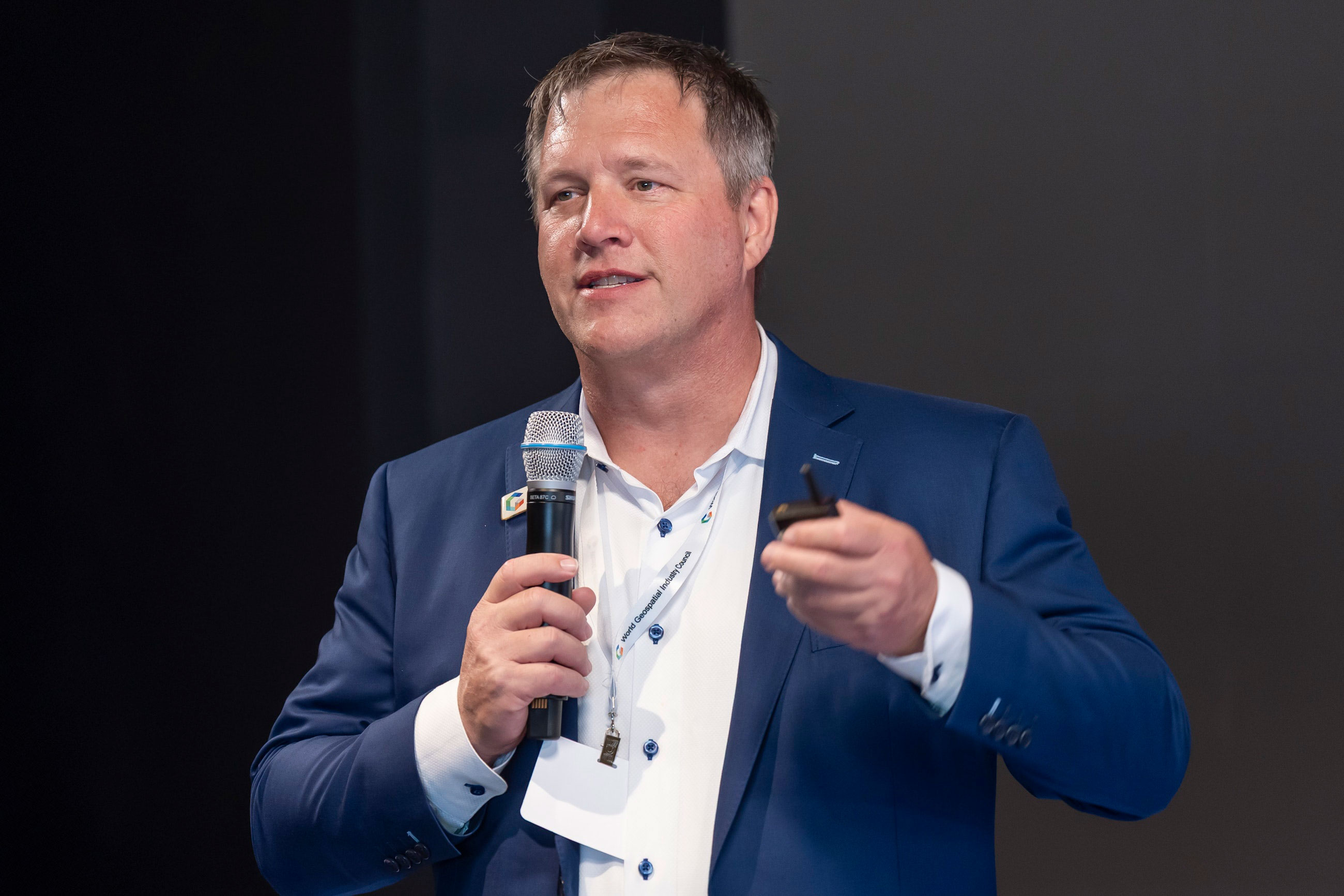
Aaron Addison, executive director of the World Geospatial Industry Council, sees the new degree as essential to connecting future professionals to industries and organizations that require a portfolio of specialized talents and skills in the geospatial realm.
“Clark is building a bridge between academia and industry in a way that advances careers while also addressing profound real-world challenges,” Addison says. “Leaders emerging from this first-of-its-kind program will be equipped and empowered to approach problems with heightened understanding, an expansive set of skills, and the ability to find meaningful solutions that have proven elusive.
“We are living in a time of incredible climate and societal disruption,” he adds, “when the demand for leaders in this space is acute — and the DGEO will be critical in meeting that demand.”
“Clark is building a bridge between academia and industry in a way that advances careers while also addressing profound real-world challenges.”
— Aaron Addison, executive director World Geospatial Industry Council
Aaron Addison, executive director of the World Geospatial Industry Council
Designed for working professionals who seek leadership positions in the geospatial industry
Clark developed the DGEO program with working professionals in mind. Through a cohort-based model, participants will take two online, asynchronous courses per semester, for a total of 12 courses (48 credits), including a capstone project, over six semesters. They will attend annual intensive, weeklong sessions to learn and network with each other and industry professionals on Clark’s campus in Worcester, Massachusetts. By studying during the summer, participants may obtain the degree within two years.
The program’s coursework will focus on strategic leadership, organizational management, financial literacy, sales and marketing, product management, and governance and policy across the geospatial sector. In addition, the program will empower students with the necessary skills to lead a GeoAI-first enterprise and be fluent in geospatial technology from sensors and data to cloud-native workflows and analytics.
The Clark DGEO program is being launched simultaneously with a similar program at the University of Southern California. While the two institutions are building distinct degrees, they are in ongoing consultation with one another to coordinate a consistent, sector-wide response to the geospatial leadership gap. USC’s program will cover similar course material and will take three-plus years to complete — one course per semester.
Clark Center for Geospatial Analytics to connect students with industry partners
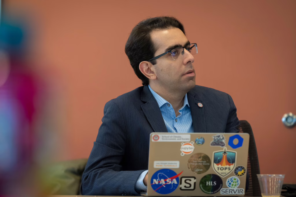
Clark’s program will draw upon the expertise of industry leaders, as well as faculty researchers affiliated with the School of Climate, Environment, and Society, the School of Business, and the Clark Center for Geospatial Analytics (Clark CGA).
Hamed Alemohammad, director of the Clark Center for Geospatial Analytics
Clark CGA serves as the formal liaison with industry partners, working to bring real-world use cases into the classroom and expand the program’s network. Participants will get the opportunity to network with employers throughout their coursework and in leadership residency weeks. Both faculty and external industry partners will coach each participant’s capstone project, which culminates the degree, ensuring these projects produce real organizational value.
“What’s really exciting is that these tools are empowering stakeholders to make better decisions in their day-to-day work and on long-term policies around climate mitigation and adaptation.”
— hamed Alemohammad, director clark center for geospatial analytics
Hamed Alemohammad, director of Clark CGA and associate professor of geography, notes that the world is experiencing a “data revolution” characterized by satellites generating more high-quality environmental data than ever before, and GeoAI is now the key to unlocking what that data is telling us.
“The geospatial industry doesn’t have a data problem, though — it has a leadership gap,” Alemohammad says. “As geospatial technologies and data become central to decision-making across sectors, organizations need leaders who can connect technical capabilities with strategy, investment, and real-world impact.”
He oversees a research team that collaborates with diverse national and private organizations — such as NASA, IBM, Esri, Verra, and Radiant Earth — to develop and apply geospatial and AI-driven solutions for climate risk, environmental monitoring, and decision support.
“What’s really exciting is that these tools are empowering stakeholders to make better decisions in their day-to-day work and on long-term policies around climate mitigation and adaptation,” Alemohammad says. Clark’s Executive Doctor of Geospatial Leadership, he adds, “is designed for that moment. It prepares experienced professionals to move beyond technical expertise and lead organizations — translating complex data into decisions that shape markets, policy, and the future of the field.”
Panelists at the launch in London for the new professional geospatial degree included, from left (above and in photo at top of story): Mark Coates, vice president of infrastructure policy advancement, Bentley Systems; Aaron Addison, executive director of the World Geospatial Industry Council; John Wilson, founding director of the Spatial Sciences Institute at the University of Southern California; and Lou Leonard, inaugural D.J.A. Spencer Dean of Clark University’s School of Climate, Environment, and Society.