Food, water, and AI: $750,000 NASA grant funds research by geography faculty, students
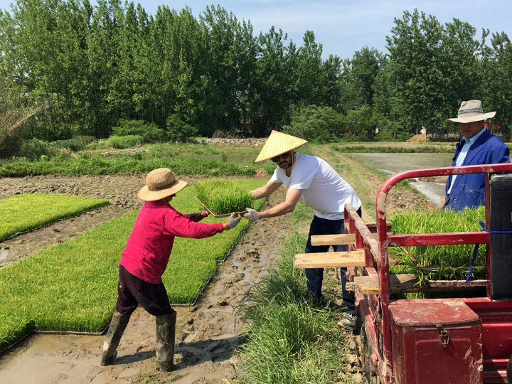
In a news photo from China, an elderly couple sits on stools beside a farm field. Nearby, six empty seats represent their adult children, who have left the land to seek prosperity in the city.
It’s a scenario that Geography Professor Gustavo Oliveira of Clark’s School of Climate, Environment, and Society understands all too well. An expert in global agro-industrial trade and food-supply systems, he has experienced the issues facing small-scale farmers firsthand. Oliveira and his wife, a professor at Amherst College, have traveled back to her native China to help her elderly parents transplant rice. No one else is available to work the farm.
For decades, food insecurity commonly — and mistakenly — has become linked to population growth, he says.
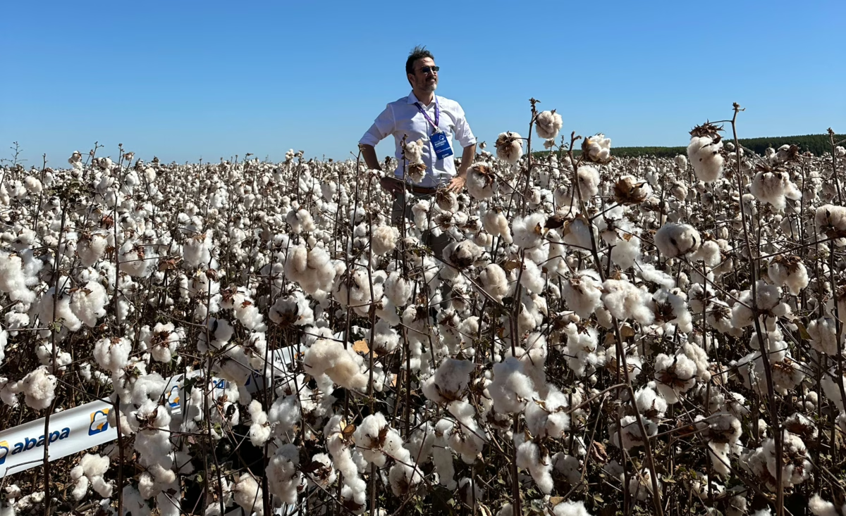
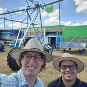
“People still rely on 20th-century thinking about overpopulation and the need to increase food production,” explains Oliveira (above, in a cotton field in Brazil’s Cerrado).
“But that way of thinking doesn’t accurately reflect our current reality, which is about urbanization, industrialization, and market forces.”
Across the world — and especially in Africa, Asia, and Latin America — foreign investors have snatched up millions of acres of farmland in a “global land grab” since 2010, he points out. The land has been turned over to expansive farm operations, resource extraction, energy production, and development.
Led by growth in Africa, the global population is expected to increase from 8.2 billion people in 2024 to as many as 10.4 billion in the mid-2080s, then start to decline, according to the United Nations. But today, much of the world — including traditional economic powerhouses like China, Brazil, the United States, Germany, and Japan — already is seeing lower fertility rates, aging populations, and slower or decreasing growth rates.
Meanwhile, young people are bypassing village life and farming for what they perceive as more promising, lucrative work in the city, according to Oliveira. The U.N. projects that by 2050, almost seven in 10 people across the globe will be urban residents.
“Not enough hands, rather than too many mouths, is the bigger challenge to food security in the future,” he says.
‘A vicious cycle where we consume water twice, to make the energy and then to plant’
Deemed a significant carbon sink due to extensive plant root systems, Brazil’s Cerrado harbors the Earth’s second-largest underground water reservoir. For years, it has been known as the region’s “Water Tank.”
Yet, the area is now threatened by deforestation and declining water tables, made worse by climate change. In addition to dealing with industrial agriculture’s impacts on the aquifer, the region has seen a 12 percent decrease in rainfall since 1980.
Brazil’s soybeans require a lot of water to grow, and industrial farms have relied on irrigation to adapt to climate change, pumping out water from the rivers and aquifers and distributing it via huge pivots in the fields, Oliveira explains. The pivoting irrigation creates green “crop circles” that dot the Cerrado.
Over four decades, China emerged as the world’s biggest pork consumer and producer, with rippling effects. To feed its hogs, many of which are confined to high-rise factories, China imports 80 percent of Brazil’s soybean crops.
Having passed the U.S. as the world’s No. 1 soybean grower, Brazil has cleared at least 11 percent of the 789,000-square-mile Cerrado, the most biologically rich savanna in the world, to plant 52.9 million acres of commercially farmed monoculture crops.
As part of a three-year, $750,000 NASA-funded project that started in 2023, Oliveira and Geography Professor Robert Gil Pontius Jr., also affiliated with Clark’s School of Climate, Environment, and Society, have been modeling future, competing scenarios of this expansion, given climate change.
“You need a lot of energy to run a lot of pumps, to pump a lot of water.”
— Professor gustavo oliveira
Deemed a significant carbon sink due to extensive plant root systems, Brazil’s Cerrado harbors the earth’s second-largest underground water reservoir.
Yet, the area is threatened by deforestation and declining water tables, made worse by climate change. In addition to dealing with industrial agriculture’s impacts on the aquifer, the region has seen a 12 percent decrease in rainfall since 1980.
Brazil’s soybeans require a lot of water to grow, and industrial farms have relied on irrigation to adapt to climate change, pumping out water from the rivers and aquifers and distributing it via huge pivots in the fields, Oliveira explains. The pivoting irrigation creates green “crop circles” that dot the Cerrado.
“There’s a vicious cycle where we consume water twice, to make the energy and then to plant the soybeans and the cotton,” Oliveira says. “You need a lot of energy to run a lot of pumps, to pump a lot of water.”
Students conduct field research in Brazil, apply geospatial science, AI to explore water scarcity
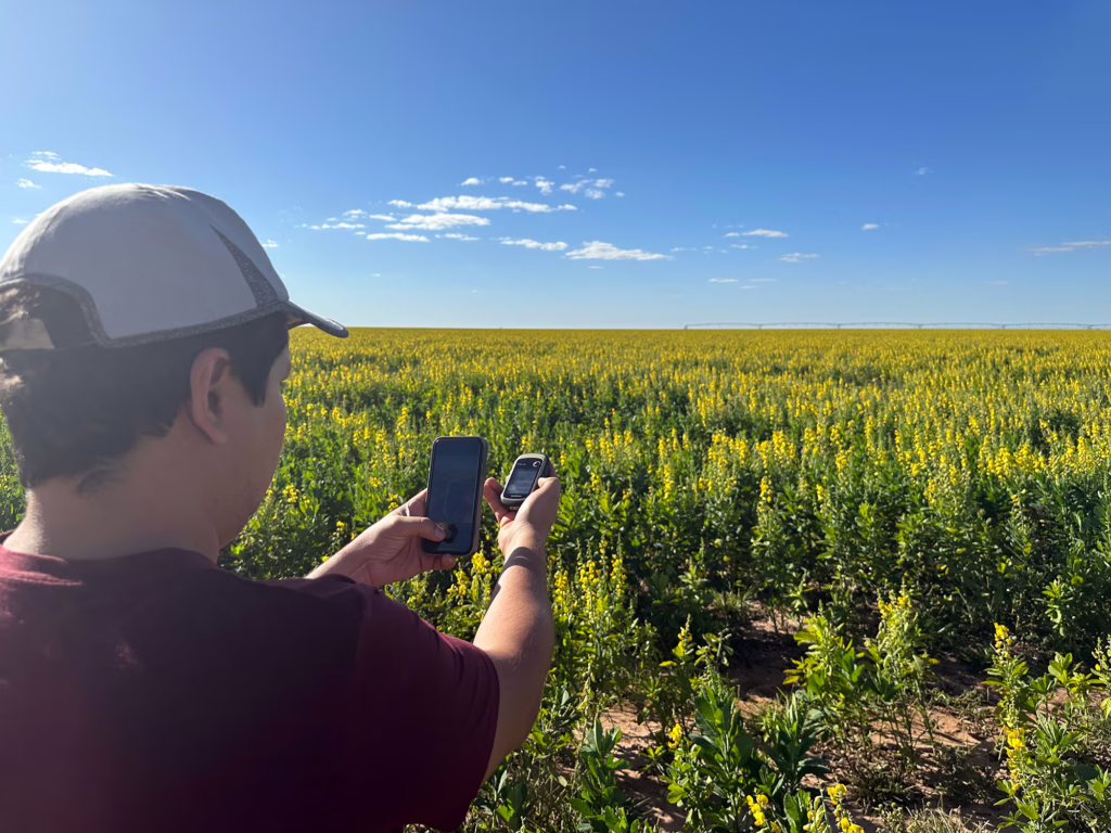
Oliveira and Pontius’ research team includes two students who conducted research over two summers in Brazil: Antonio Victor Galvão da Fonseca, a third-year Ph.D. student in geography, and Rowan Compton ’25, M.S. ’26.
Compton’s undergraduate honors thesis focused on his research with the project. In summer 2024, a Clark Steinbrecher Fellowship funded the geography major’s research at the Amazon Environmental Research Institute, where he studied land use and water scarcity in the Cerrado.
“I’ll be working on this project through the rest of my Clark career, and I’m sure it’ll travel with me beyond Clark,” he said after his first trip in 2024. “This is the kind of thing that is influential for a lifetime.”
Last summer, Compton returned to Brazil for more field work, and now continues his work on the project through Clark’s 4+1 Accelerated Master’s in GIS. Recently, Oliveira submitted an article that draws upon Compton’s honors thesis to a professional journal.
Faculty-student team applying geospatial science, artificial intelligence to gain insights
To understand where irrigation and agriculture could expand, Pontius, an expert in geospatial science and mathematical modeling, is using satellite data to develop more comprehensive maps.
In summer 2024, Fonseca joined Oliveira in Brazil to collect GPS points for mapping the crop fields that rely on pivot irrigation. Last summer, he and Compton interviewed farmers and other community members about their observations about changes in the landscape due to large-scale agriculture and pivot irrigation.
More recently, Fonseca and Pontius have expanded their mapping and geospatial research to use artificial intelligence and cloud computing to improve a free, open-source research tool available on GitHub. Created at Clark, the tool allows users to process large datasets remotely and better analyze complex patterns of land change over time, in any region of the world.
“Everything is related to water and how they are using land in this region.”
— Antonio Fonseca, geography Ph.D. student
To support their research using AI to improve the land-cover data tool, Fonseca and Pontius were awarded a grant from the Clark AI Innovation Fund, established with a $50,000 gift from the Yee Family, including Trustee Brian Yee ’93.
They are using the tool to examine time-series data and maps for the research project in the Cerrado. The tool is based on a novel methodology that Pontius developed with Thomas Bilintoh, Ph.D. ’24, that helps researchers identify frequently overlooked, yet meaningful, patterns in long-time series of land-cover maps.
“There is a lot of concern about the irrigation in the region, and it affects different stakeholders,” Fonseca says. “Everything is related to water and how they are using land in this region.”
Yet, even with “the land changing, the trees being cut down, and communities being displaced, they don’t yet see the big picture of climate change,” he explains. “The results of our study may provide a way for stakeholders to better understand how land use is related to climate change.”
Brazil’s massive irrigation projects underscore a significant global problem: Across the globe, agriculture uses 70 percent of the world’s freshwater resources, according to scientific studies.
“Food and water are deeply interconnected,” Oliveira says. “And with climate change, we have increased reliance upon irrigation to produce food, but we also have reduced capacity to sustain that irrigation.
“It’s a Catch-22 that comes down particularly forcefully in industrial food systems,” he adds, “which are chemical- and capital-intensive and drive further climate change.”
Photos courtesy of Gustavo Oliveira, Rowan Compton, and Antonio Fonseca