
Andre Bergeron ’25, M.S./GIS ’26, works at intersection of data science and environmental science
During his Clark career, Andre Bergeron ’25, M.S./GIS ’26, has spent a lot of time looking at maps — and has been all over the map. Bergeron, who will graduate in May with a Master’s in GIS and who majored in geography and environmental science on the earth system science track as an undergrad, has done internships in North Carolina, Utah, and Worcester.
This summer, he’ll head to California to intern as a product engineer at Esri, the global market leader in geographic information system (GIS) software, location intelligence, and mapping. While at Esri, Bergeron will work on the geocoding team in the software services division.
Bergeron was able to network with professionals last year when he attended Esri’s Federal GIS conference in Washington, D.C. He applied for Esri’s Student Assistantship Program to attend the conference as an assistant, an opportunity Esri offers to help GIS students break into the field.
“I was able to see all of Esri’s technology and how different government agencies were leveraging Esri’s tools to solve their problems,” he recalls, noting that the National Oceanic and Atmospheric Administration (NOAA), National Aeronautics and Space Administration (NASA), and U.S. Geological Survey (USGS) were among the agencies at the conference. “That was a big moment in my academic/professional career because I was able to network and meet the recruiter who helped me get this Esri internship.”
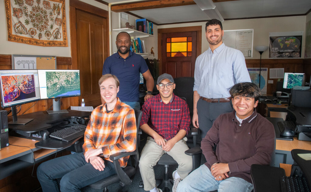
During the spring and fall 2025 semesters, Bergeron worked as a research assistant for Clark’s Center for Geospatial Analytics. He contributed to a collaborative project between CGA and the Gordon and Betty Moore Foundation by mapping coastal landcover maps in select countries in the global tropics. He updated maps of mangrove ecosystems, coastal wetlands and pond aquaculture using Clark’s TerrSet GIS software and satellite imagery.
The 4+1 Accelerated Degree Program is one of the reasons Bergeron chose Clark, but GIS wasn’t on his radar at all. He had intended to pursue biology, but took a GIS course his sophomore year and stuck with it. Bergeron says the ability to talk one-on-one with professors has been helpful throughout his time on campus.
“I’ve found myself now wanting to use this fifth year to broaden my skills in programming and data science,” says Bergeron. Those skills strengthen his work in GIS but also apply to other fields he could explore in the future, and will be used during his Esri internship this summer.
Within GIS, Bergeron enjoys analyzing relationships between social and physical phenomena.
“I like working with satellite data, a specific data type in GIS and remote sensing that represents information as a grid of pixels, which is often used for continuous data such as elevation or temperature,” he says. “I like being able to provide solutions for why a certain phenomenon might be occurring or for helping decision-makers make better decisions.”
Bergeron put this practice to work last year during an Advanced Remote Sensing course. He analyzed the differences between model-based data and satellite-based data, evaluating their effectiveness in mapping vegetation in Mozambique, working with three other students under the supervision of Geography Professor John Rogan.
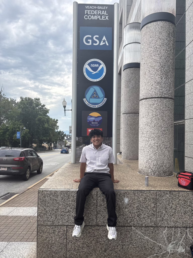
Bergeron interned at NOAA in summer 2025, spending 10 weeks on location at the headquarters of NOAA’s National Centers for Environmental Information in Asheville, North Carolina. His primary focus was working with a new computational tool that NOAA is developing called Open Information Stewardship Service, to improve data preservation, accessibility and sharing practices.
“You can use the computational framework to enrich environmental data, like weather data, with attributes like a timestamp, author, data provider, etcetera,” says Bergeron. The experience made him realize he enjoys working at the intersection of data science and environmental science.
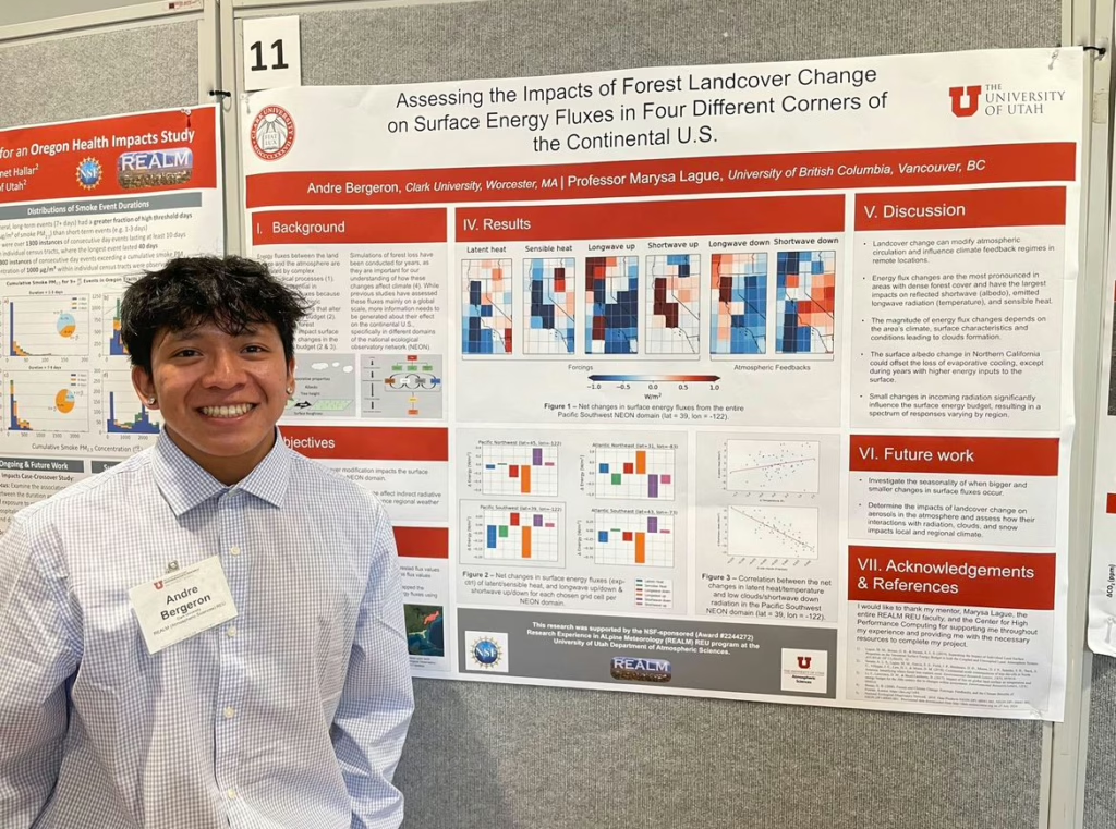
During summer 2024, Bergeron traveled to Utah and Colorado and completed the University of Utah’s Research Experience in ALpine Meteorology, a nationwide program funded by the National Science Foundation. He worked on programming with Python and learned more about atmospheric science and alpine meteorology.
“That internship very much got me into programming and helped me get to where I am now,” he says. “That was the moment when I felt like I discovered my passion for GIS remote sensing, programming, and data science.”
Bergeron applied the skills he learned from the project in Utah to his honors thesis, which helped him earn highest honors in both environmental science and geography.
After graduation and his summer internship, Bergeron hopes to land a job involving GIS remote sensing, data science, and Earth science.
During his free time on campus, Bergeron has been a part of the Clark Undergraduate Geography Association and performed in the 2023 International Gala. He has been part of the international Geography Honors Society and received Clark’s Center for Geospatial Analytics GIS Excellence Award. As a sophomore, he participated in the Emerging Leaders Institute. He’s also served as a peer mentor and a Connections@Clark student mentor, and studied abroad in Costa Rica during his junior year. In February, he participated in the Clark Experience Expo, sharing insights on his Clark journey with younger peers.