
Wildfires have become part of our lives
Whether they have read the headlines about regions devastated by fire, stayed inside to avoid smoke, or noticed changes in the sky, this generation of students is witnessing the impacts. Wildfires are reshaping landscapes, communities, markets, and affecting the air we breathe.
At Clark students work side-by-side with faculty mentors on research that helps us better understand fires and decide how to act.
Classes venture into conservation areas and burned forests with faculty to examine burn scars on trees and record their observations. They work with communities to monitor tree health and use satellite data to track and predict future wildfires.
What it’s like to study a forest after a fire


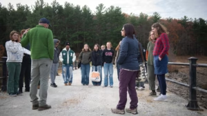
Every fall, geography professor, Dominik Kulakowski teaches a field methods seminar that brings students into the Massachusetts woodlands to learn basic observation exercises and data collection techniques. Students investigated Spenser State Forest and Mount Pisgah Conservation Area in Northborough — both post-fire landscapes — to study cambium mortality in burned trees. Cambium is the thin layer just under the bark that carries water and nutrients up the trunk — enough damage there, and the tree dies. The group tested a faster, less invasive way to measure that damage, developed for Western wildfires, to see if it holds up in New England.


Kulakowski, who has testified before Congress on climate-driven disturbance, pairs ground observations with GIS and satellite data in his own research. “Field-based observations are essential for knowing what we’re seeing in our remotely sensed imagery,” he says. “To develop sound policy, we need a grasp of the underlying science, too.”
Explore programs


An advanced degree within reach
The 4+1 Accelerated Master’s provides an opportunity to earn a pathway to a master’s degree — with one year of additional study and available tuition scholarships.
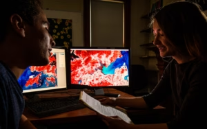
Clark’s accelerated GIS master’s pairs internationally recognized geospatial research with real-world work for communities, nonprofits, government, and industry.
Multidisciplinary perspective
Clark students draw from a solid foundation across a broad range of disciplines — literature, economics, philosophy, visual culture, and psychology — as they consider how they want to contribute
Building on decades of research on children and families, psychology professor Wendy Grolnick contributes to communities in the aftermath of a disaster. In this episode of Challenge. Change. podcast, she describes the disaster response work she does through the American Red Cross.

French professor Odile Ferly’s course, Decolonial Ecologies in the Caribbean, focuses on literature and film and the human response to environmental change.

English professor Stephen Levin’s course, Ecofictions, pairs Thoreau and Amitav Ghosh with discussions of current climate events, asking what it means to be human on a changing planet.

Clark’s climate research spans the natural sciences, social science, and humanities.

How are wildfires connected to climate change?
Geography Professor Abby Frazier was a lead author on Hawai‘i and Pacific Islands to the U.S. government’s Fifth National Climate Assessment.
“Climate change continues to threaten things we care about,” she says. “As the devastating hurricane-fueled wildfires on Maui and Typhoon Mawar in Guam made clear, when communities are already hurting from stressors like COVID-19, extreme weather can multiply harms.”
As the fires swept through Lahaina in Maui in August, 2023, journalists from CNN and Anderson Cooper 360, the New York Times, the Los Angeles Times, Washington Post, BBC Radio, and other outlets reached out to Frazier about whether climate change was to blame for the Maui inferno. “There’s likely a climate change signal in everything we see,” she told the New York Times.
“The sooner we scale up global action to curb threats from climate change, the better. Fortunately, cutting emissions or preparing for new extremes also creates immediate local benefits — improved health, a stronger economy, and more resilient communities.”
Abby Frazier
Geography professor
In the news
Clark faculty are often the first call for news media and policy makers.