Clark has a long legacy of connections to NASA, the federal agency formed in 1958 at the dawn of the Space Age — a moment that would not have happened without alumnus and Physics Professor Robert Goddard’s research and launch of the first liquid-fueled rocket, in a field not far from campus, on March 16, 1926.
Over the years, NASA has funded Clark faculty and student research, mostly tied to the University’s pioneering development and use of geospatial information science and remote sensing technology to harness space satellite data in studies of the Earth’s changing climate and environment.
Today, those connections live on through NASA-funded research in the School of Climate, Environment, and Sustainability and the affiliated Clark Center for Geospatial Analytics (CGA).
NASA has recognized this research with awards, fellowships, and grant funding. Below are some of the more recent awards.
Clark CGA’s innovations in geospatial AI
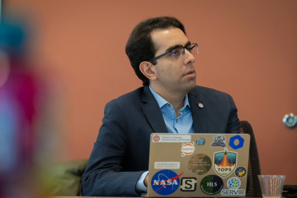
Over several years, Clark CGA Director Hamed Alemohammad and members of his research team — graduate students and post-doctoral scholars — have won multiple awards as members of the AI-Powered Geospatial Foundation Model team, collaborating with NASA and IBM to develop the world’s first geospatial AI foundation model.
Their awards include:
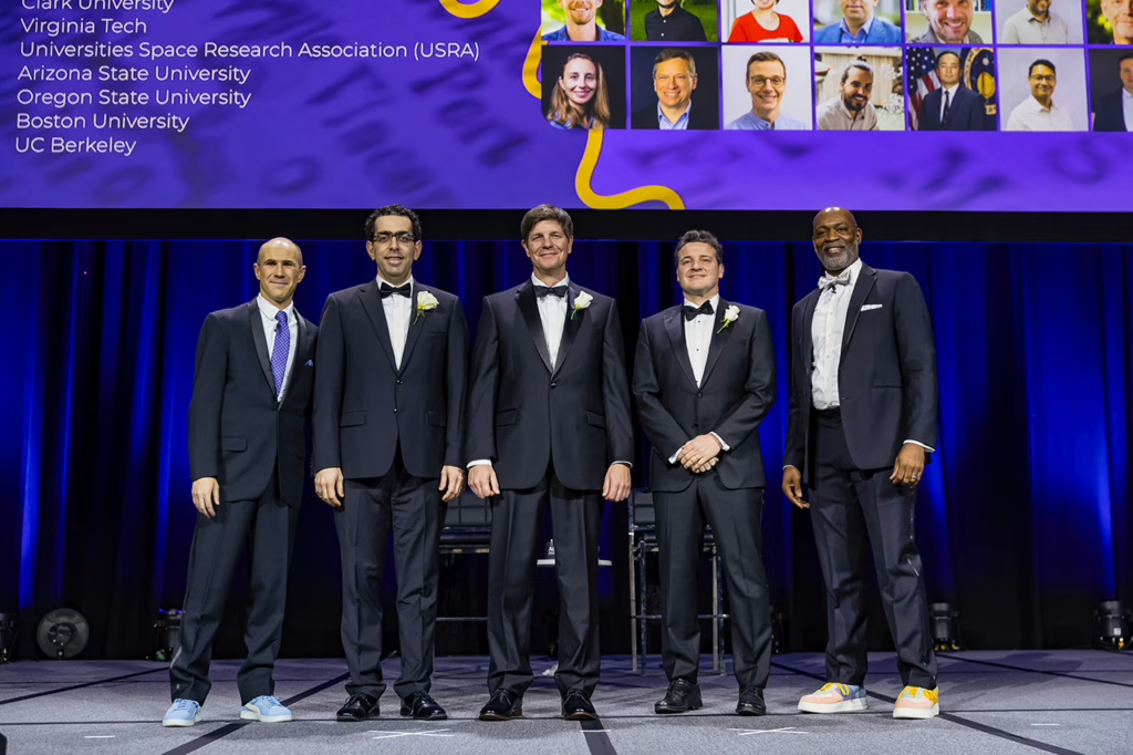
- The 2025 AGU Open Science Recognition Prize, awarded to Alemohammad; Rufai Omowunmi Balogun, and Denys Godwin, both research assistants and doctoral students in geography; Sam Khallaghi, Ph.D ’24, now a postdoctoral researcher at Clark; and Yao-Ting Yao M.S. ’23, a software engineer at Clark CGA.
Last December, the AGU (American Geophysical Union), the world’s largest Earth and space science association, presented the prize at its annual meeting and awards, which Alemohammad affectionately calls “the Oscars of the Nerds,” and where team members donned tuxedos to accept their prize.
- The 2024 NASA Group Achievement Award honored Alemohammad as the Clark CGA team lead.
- The 2024 NASA Marshall Space Flight Center Group Achievement Award went to Alemohammad, Godwin, and Khallaghi; Maryam Ahmadi, M.S. ’23; Michael Cecil, M.A. ’14, Ph.D. ’24; Fatemeh Kordi, a Ph.D. student in geography; and Steve Li, M.S. ’24.
Ph.D. student receives NASA Lifelines funding
In another NASA- and GeoAI-related project, Rufai Omowunmi Balogun, a Ph.D. student in the Graduate School of Geography and research assistant with Clark CGA, received a fellowship to work with NASA Lifelines and serve as lead author on a recent report, “GeoAI for Humanitarian Action,” which “explores how artificial intelligence and satellite data can strengthen humanitarian decision-making, while identifying the practical barriers that limit adoption.”
In a LinkedIn post, Balogun — currently a Data Fellow at the World Bank’s Global Facility for Disaster Reduction and Recovery — mentioned “one key highlight from our findings: Success in humanitarian GeoAI should not be measured solely by model sophistication but by: lives saved, better resource allocation, faster response times, increased preparedness and strengthened local agency. Bridging the gap between scientific performance and operational impact requires co-design, transparency, trust, and alignment with humanitarian workflows.”
Faculty and student research funded by NASA
Over the years, Clark faculty researchers have received millions of dollars in funding from NASA. Faculty from the School of Climate, Environment, and Society who are currently funded by NASA grants include geography professors Alemohammad, Lyndon Estes, Gustavo Oliveira (in top photo, conducting research in Brazil), and Robert Gilmore Pontius Jr.
The funding also supports undergraduate and graduate students conducting research in faculty labs on campus and in the field.
The current NASA grants include:
“Country-Scale Field Boundary Mapping Using Advanced AI Models Applied to Multi-Source High-Resolution Satellite Imagery,” a two-year, $350,000 grant supporting principal investigator Estes’ research to deploy artificial intelligence and very-high-resolution (VHR) satellite imagery to produce better maps that will help policymakers and scientists understand sweeping land transformation in Africa. He and graduate students in his Agricultural Impacts Research Group are working with Alemohammad, also a principal investigator.
“Agriculture, one of the largest drivers of terrestrial habitat loss and climate change, is fundamental to human health and well-being, and plays a critical role in socio-economic development,” according to their grant summary. “However, tracking agricultural change is difficult because of the uneven availability and varying quality of data, particularly in Africa.
“To understand how agricultural systems are changing, it is necessary to map field boundaries at national to regional scales on an annual basis.”
Working with graduate students in Estes’ research group and Clark CGA, they aim to “generate a seven-year series of country-scale field boundary maps in Ghana, Zambia, and Tanzania, and use them to analyze agricultural change.”
“Irrigation as Climate-Change Adaptation in the Cerrado Biome of Brazil Evaluated with New Quantitative Methods, Socio-Economic Analysis, and Scenario Models,” a three-year, $750,000 grant supporting research by principal investigators Oliveira and Pontius, and research in Brazil and on campus by Rowan Compton ’25, M.S. ’26, left, and Antonio Fonseca, a Ph.D. student in geography.
They are modeling future, competing scenarios of agricultural expansion, given climate change, in the Brazilian Cerrado, “one of the most important and threatened ecosystems in the world in terms of carbon fluxes, water resources, biodiversity, and social diversity including Indigenous and other traditional communities,” according to their grant summary.
“Agricultural expansion has become central to the Cerrado’s regional development and global food security, with western Bahia state being one of the most active agricultural frontiers worldwide,” they say. “However, climate change is altering the dynamics of agricultural production in the region whereby a hotter and drier climate is driving an increase in irrigation to guarantee the viability of large-scale commercial agriculture. Yet, researchers still poorly understand the manner and extent to which this form of adaptation is taking place.”
Their research on the ground in Brazil and in the lab, using geospatial AI technology, aims to understand how the land in changing.