-
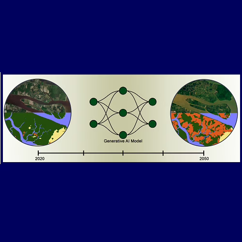
Land Cover Change Modeling using GenAI (Collaboration with WashU)
This project leverages generative AI models to project future land cover changes using historical satellite imagery and land cover maps. By exploring three novel AI modeling approaches, we aim to enhance the accuracy in predicting environmental transformations. The project addresses critical geospatial challenges by supporting sustainable land-use planning and climate resilience strategies. Anticipated outcomes include…
-
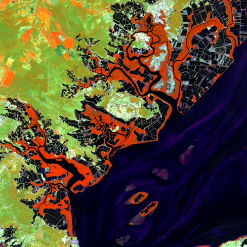
Pond Aquaculture and its Impact on Mangroves and Other Coastal Wetlands
Since 2013, Clark Labs has had a succession of grants from the Gordon and Betty Moore Foundation to map the development of brackish pond aquaculture and its impact on mangroves and other coastal wetlands in 17 countries in the global tropics. Mapping is based on Landsat 8/9 OLI imagery pan-sharpened to 15m resolution, supplemented with…
Clark University

Hours of operation
Mon-Fri, 9 a.m. – 5 p.m.
Contact information
Center for Geospatial Analytics
Be a force for change.
Find out more about graduate education at Clark.

Invest in the next generation of Clarkies.