Mapping the Blue Economy: A Decade of Monitoring Aquaculture with the Moore Foundation
Since 2014, Center for Geospatial Analytics (Clark CGA) has partnered with the Gordon and Betty Moore Foundation to tackle critical questions in environmental conservation particularly as it relates to sustainable seafood production. Established by Intel co-founder Gordon Moore and his wife Betty Moore, the foundation uses science and technology to solve pressing global problems. One of these challenges is finding the balance between growing food demands and the preservation of natural ecosystems.
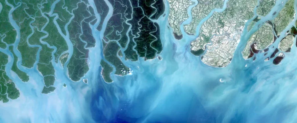
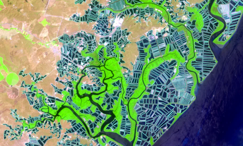
To address this delicate balance, and with support from the foundation’s Oceans and Seafood Markets Initiative, this project brings transparency to the global seafood supply chain by monitoring the rapid expansion of aquaculture. Specifically, the team utilizes satellite imagery to identify exactly where shrimp farming is encroaching on vital coastal mangrove forests.
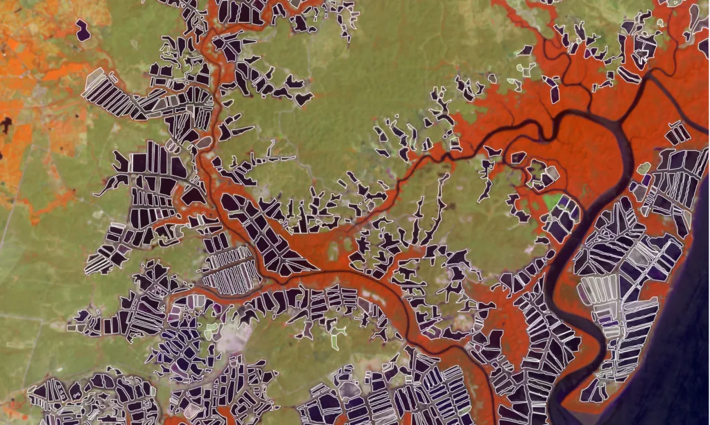
The scope of this monitoring has grown significantly since the project first launched with a focus on Thailand, Cambodia, and Vietnam. Over the last decade, the initiative expanded to track land cover changes across 17 different countries. By analyzing satellite data over specific time intervals, the team can visualize exactly where mangrove forests are being cleared to make way for aquaculture ponds or where reforestation of mangroves is happening.
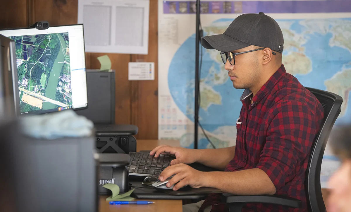
Now in its sixth phase, the project has reached a new level of technical maturity. According to Rishi Singh, Clark CGA Research Scientist who started as a student researcher on the project nearly a decade ago, this final year has been defined by a major increase in efficiency. After ten years of development, the team now utilizes robust baseline maps and specialized software. Singh notes that these tools allow the current team of student Research Assistants to process data and generate maps faster and more accurately than ever before.
This speed and accuracy are crucial because, unlike traditional academic research that often stays within the university ecosystem, this project delivers tangible products used by major industry players. The maps and data produced by Clark CGA are distributed through a web dashboard and downloaded by organizations responsible for auditing sustainability of food production.
One of the most prominent partners relying on this data is the Monterey Bay Aquarium’s Seafood Watch program. When Seafood Watch assesses a region for its consumer sustainability ratings, they use maps from Clark CGA to audit the environmental impact of farming in that area. Their findings directly influence the purchasing decisions of major retailers like Whole Foods and Costco, as well as certification bodies like the Aquaculture Stewardship Council (ASC). By empowering major market leaders, the project exemplifies the core mission of Clark CGA: to drive the progress of geospatial analytics for sustainable environmental stewardship. This initiative grants Clark University students the opportunity to address pressing global conflicts while producing data that guides sustainable purchasing decisions. As the current phase concludes, it leaves behind a legacy of high-quality data and a proven methodology for safeguarding vital coastal ecosystems.