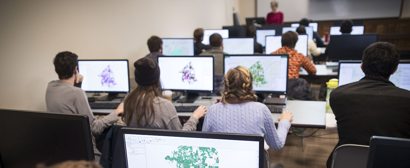
Housed in the Jefferson Academic Center, the Graduate School of Geography maintains high-performance computing environments for teaching and research. Founded at the school and located across the street, Clark Labs is a research center focused on the development of geographic information technologies, maintaining state-of-the-art computing and data facilities for software development and research applications.
Faculty members’ individual laboratories, which include a diverse range of field and lab equipment, are housed in Jefferson and the Lasry Center for Biosciences.
Agricultural Impacts Research Group
Professor Lyndon Estes’ Agricultural Impacts Research Group is equipped with two fixed-wing UAS: a Skywalker with thermal and visual and near-infrared imagers, and an RTK/PPK-capable Sensefly Ebee Plus with Sequoia+ multispectral camera. The group also has a suite of Arable Mark environmental sensors.
Biogeosciences Research Group
Professor Christopher A. Williams’ Biogeosciences Research Group is equipped with a wide array of micrometeorological and ecophysiological field equipment, including eddy flux and leaf gas exchange instrumentation; tools for measuring plant and soil properties, including portable leaf area and leaf area index meters; a handheld ASD field spectroradiometer; clinometers; meter tapes; handheld air and soil temperature and moisture sensors (Omega, Campbell Scientific); sling psychrometers; drying ovens and balances; soil corers; soil sieves; hydrometer bulbs, plus glassware for texture analysis; streamflow meters and waders; and soil augers. The Williams lab also has several many-processor desktops (≅100 CPUs) and a large volume of networked and desktop data storages.
Clark Labs
 Directed by Professor J. Ronald Eastman, Clark Labs is a research center that develops and employs geospatial technologies for environmental management, sustainable resource development, and equitable resource allocation.
Founded at Clark, the lab is world-renowned for its geographic information system (GIS) and geospatial analytics software, including TerrSet Geospatial Monitoring and Modeling, an integrated feature-rich software system for monitoring and modeling the Earth system for sustainable development; the IDRISI Geographic Information System tool set; the Land Change Modeler; and the Earth Trends Modeler. IDRISI was the first GIS software system specifically targeted at a microcomputer platform. Since its introduction in 1987, it has grown to become one of the most widely used raster systems of its type with installations in more than 180 countries.
Partnering with such organizations as the Gordon and Betty Moore Foundation, Esri Inc., Conservation International, World Conservation Society, the U.S. Department of Agriculture, and the United Nations, Clark Labs leverages its academic base to develop innovative and customized research tools, provide software solutions to organizations in need, and apply geospatial expertise to a range of real-world problems. Clark Labs has the largest proportional research and development budget in the industry devoted to the analytical development of geographic information technology.
Landscape Monitoring Research Group
The Landscape Monitoring Research Group, led by Professor John Rogan, is equipped with field instruments for use in forest health inventory, including densitometers, hypsometers, dbh tapes, and calipers. The lab also contains a suite of GPS receivers, HOBO temperature sensors, and quantum light meters. The lab serves as a long-term geospatial data repository for the Human-Environment Regional Observatory program and the Extractive Industries Research Group.
Earth Observation and Remote Sensing Lab
The Earth Observation and Remote Sensing (EORS) Lab provides computing and office space infrastructures for graduate students focused on earth system science, remote sensing, and geographic information science within the Graduate School of Geography.
Forest Ecology Lab
The Forest Ecology Lab, led by Dominik Kulakowski, is equipped with a suite of field and lab equipment that supports experimental and observational research on forest ecosystems. This includes equipment for field observations (including GPS units, forest canopy densitometers, near-surface light and temperature meters, and measuring tapes), dendroecological data collection and analysis (including increment borers, sanders, Velmex Tree Ring Measuring Systems, and a CDendro semi-autonomous dendroecological processing system), and analysis of spatial data (including ArcGIS and TerrSet Geospatial Monitoring and Modeling Software).
Polar Science Research Lab
 Led by Professor Karen Frey, the Polar Science Research Lab includes a wet lab facility located in the Lasry Center for Bioscience building and equipped to perform biogeochemical analyses on freshwater and seawater samples. In addition, the lab houses multiple pieces of equipment and supplies that are routinely transported to the Arctic for remote field campaigns.
Equipment on campus includes an 18-megaohm clean water source, multiple freezers and refrigerators, fume hood, a drying oven, a muffle furnace, research computer, along with field observation equipment: pH/DO/temperature/conductivity meters, a Shimadzu UV-1800 UV-VIS spectrophotometer, a Turner Designs Trilogy Laboratory Fluorometer, analytical balances, glassware, Kemmerer water samplers, and a Biospherical Compact Optical Profiling System (including two profiling radiometers, a QCP-PAR sensor, and a surface reference radiometer with a large metal tripod).