
Geospatial Research
Explore our cutting-edge research in GeoAI, land change modeling, REDD, uncertainty modeling, and geospatial software development. Our work advances geospatial analytics to address real-world challenges with innovative solutions.
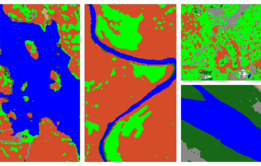
Geospatial AI
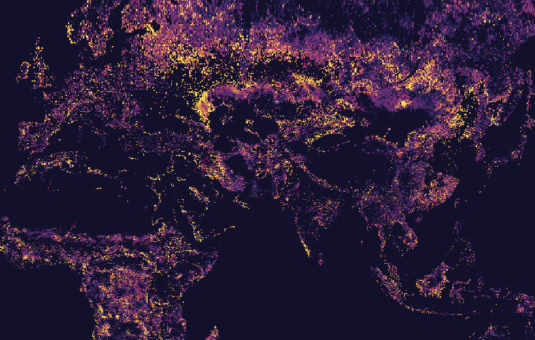
Geospatial AI is revolutionizing the way we monitor our planet by unlocking valuable insights from petabyte-scale data available from diverse geospatial sensors and empowering stakeholders to make data-driven decisions. Our research focuses on developing innovative AI-powered tools and methods to address a wide range of challenges, from climate change to conservation. In addition, to increase utility of geospatial AI models we are developing explainable AI (XAI) benchmarks that are designed to characterize the accuracy, transparency and transferability of these models.
We are exploring the potential of foundation models for Earth Observations to extract information from satellite imagery where/when limited ground reference data is available. These models are initially built using a significantly large number of observations (from 10s of millions to 100s of millions) and then customized for specific applications or geographies using limited available data. Such a paradigm shift in model development requires collaborations across different sectors (research, government, and commercial); hence, we have been working very closely with multiple partners including NASA and IBM in this area.
Land change modeling
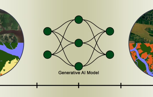
The dynamics of Earth trends is most evident by our changing landscape and land change modeling is crucial for understanding these complex dynamics. Our research investigates the underlying drivers of land use and land cover change, such as urbanization, deforestation, and agricultural expansion. By developing custom models and tools to identify the driving forces of change, we can simulate future land change scenarios and assess their potential impacts on ecosystems, biodiversity, and human well-being. We employ a variety of modeling techniques, including classical statistical models as well as advanced generative AI models to capture the spatial and temporal patterns of land change.
Our team has collaborated with many stakeholders throughout the years, including Conservation International, to develop the Land Change Modeler (LCM) tool in TerrSet. LCM provides the most comprehensive and advanced set of change analysis procedures for measuring our changing landscape and assessing the impacts of this change at both local and global scales. These procedures include Markov Chain Analysis, Cellular Automata, Logistic Regression and Multinomial Logistic Regression, GEOMOD, and Neural Networks
REDD
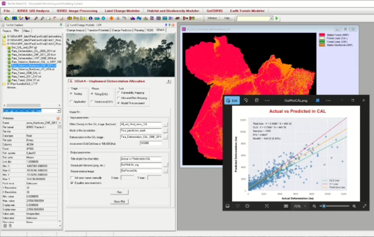
Our research supports Reducing Emissions from Deforestation and Degradation (REDD) initiatives by providing the scientific tools and data needed to monitor forest carbon stocks, detect deforestation and degradation, quantify risks of deforestation, and assess the effectiveness of conservation measures. TerrSet LCM has a tool for REDD analysis that facilitates the estimation of baseline emissions from various carbon pools and allows the calculation of deferred emissions and carbon credits.
In addition, we collaborate with leading organizations such as Verra and TerraCarbon to address the accuracy and transparency of REDD projects and support Jurisdictional and Nested REDD (JNR), a framework that helps governments protect and manage forests and mitigate the impacts of climate change. Through this collaboration our team has developed the Unplanned Deforestation Allocated Risk Modeling and Mapping Procedure tool (UDef-ARP) which is also available in the latest TerrSet liberaGIS release.
Uncertainty modeling
Uncertainty is inherent in all geospatial data and model predictions. Our research focuses on quantifying the uncertainty in data and models, and propagating the uncertainty to the outputs presented to stakeholders to improve the reliability and robustness of decisions. We employ statistical methods, such as Bayesian modeling and Monte Carlo simulation, to assess these uncertainties.
Moreover, with rapid advancements in geospatial AI techniques, it is paramount to quantify uncertainties in data that are input to AI models during training as the model learns these uncertainties as part of the patterns in the data. By characterizing these uncertainties and deploying mitigation strategies during training, we ensure the models have a robust training cycle, so that they can be deployed to handle real-world scenarios.
Geospatial software development
Geospatial software is essential for making geospatial data and analysis accessible to a wide range of users. Our software development team is dedicated to creating user-friendly software tools that empower researchers, policymakers, and the public to explore and analyze geospatial data. The key to our success is that the software development team works closely with researchers to incorporate the latest methodologies, and ensure their implementation follows a scientific rigor.
Our software development efforts span development of TerrSet, an integrated system for geospatial analytics, to customized pipelines and tools that are designed for various projects and stakeholders. We embrace open-access and open-source software practices and publish all our software packages for free. We advocate for FAIR (Findable, Accessible, Interoperable and Reusable) data principles and publish our datasets following these guidelines. In addition, as a member of the Cloud Native Geospatial Forum, we foster the latest best practices and advancements is cloud-native data and software development.