
Extractive industries, livelihoods and natural resource competition: Mapping overlapping claims in Peru and Ghana
Peru and Ghana share the challenge of having to manage relationships between two sectors (resource extraction and agriculture) that are each important for economic growth and poverty reduction. Using national-scale visualization, cartographic representation and spatial analyses, this research explores the relationship between territories of extraction and livelihood territories.
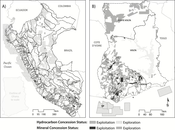
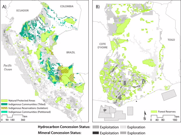
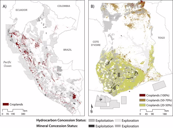
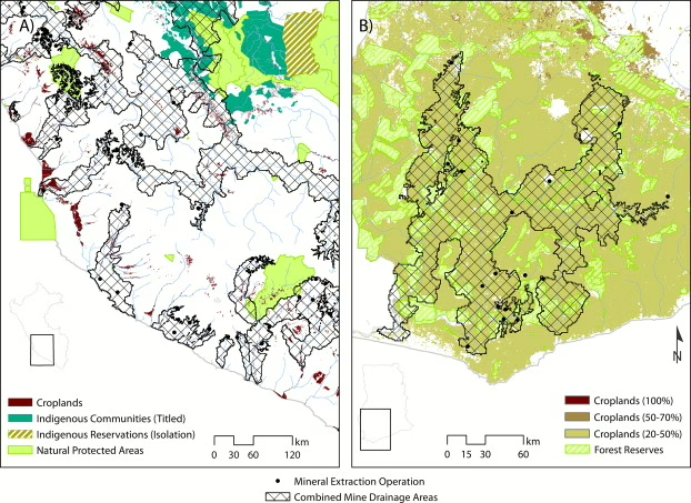
Territories of extraction consist of mineral concessions, hydrocarbon concessions, and mine drainage areas. Livelihood territories consist of river basins, agricultural land cover and protected areas.

Student research
For student research on the spatial overlap of extractive industries and livelihood territories in the United States, they may work with several federal agencies to provide relevant data and mapping tools.